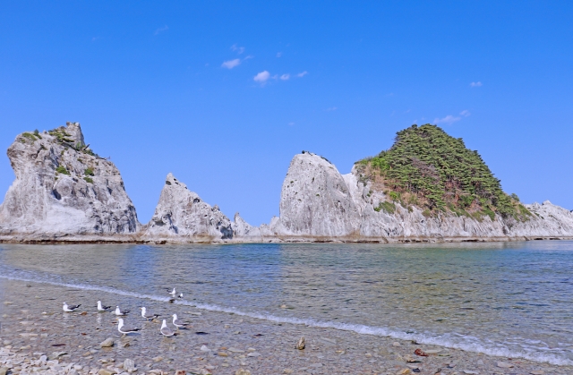
About Rikuchu Kaigan National Park
Established in May 1955, Rikuchu Coast National Park is a national park that stretches 180 kilometers from north to south along the Pacific Ocean coastline, covering an area of more than 121 square kilometers, spanning the cities of Kuji, Iwate Prefecture and Kesennuma, Miyagi Prefecture in northeastern Japan. The park is one of the most popular national parks in the northeastern region because of its beautiful scenery and the unusual scenery of cliffs and jagged rock formations.
Rikuchu Coast National Park is best known for the northern section of the Sanriku Coast, which is included in the park and is visited by a large number of tourists from home and abroad every year. The Sanriku Coast is one of the few most famous drowned coastlines in Japan, spanning the Pacific Ocean between Aomori, Iwate and Miyagi prefectures, and is approximately 600 kilometers long. The Sanriku Coast is divided into two sections, the north and the south, with the central Miyako City as the boundary.

How to get there
<Aomori Prefecture Area
From the Hachinohe IC of the Hachinohe Expressway, take the open road to Shark Station.
<Northern Iwate Prefecture Area
From Hachinohe Expressway, get off at Kudo IC and take the open road to Kuji Station.
<Central Iwate Area
Take the Tohoku Expressway, get off at Morioka Minami IC, and get off at Miyako Station on the open road.
<Southern Iwate Area
Take the Tohoku Expressway, get off at Ichinoseki IC, and get off at Mori Station on the open road.
<Miyagi Prefecture Area
Tohoku Expressway Ichinoseki IC to Kesennuma Station by open road or Sanriku Expressway Ishinomaki-Konan IC to Ishinomaki Station by open road
Tips
The northern section, located in the Rikuchu Coast National Park, is a coast formed by the uplift of the earth, with cliffs stretching all over the place, and is the main attraction for visitors to the national park, including Jodo-hama, Kitayamazaki, and Ryusendo.
Website
https://www.env.go.jp/en/nature/nps/park/sanriku/index.html